Not yet confirmedUnder investigation. Here is what is known and what still needs proof.
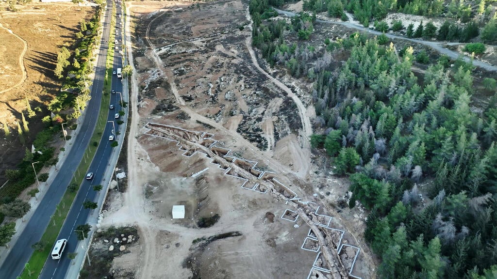
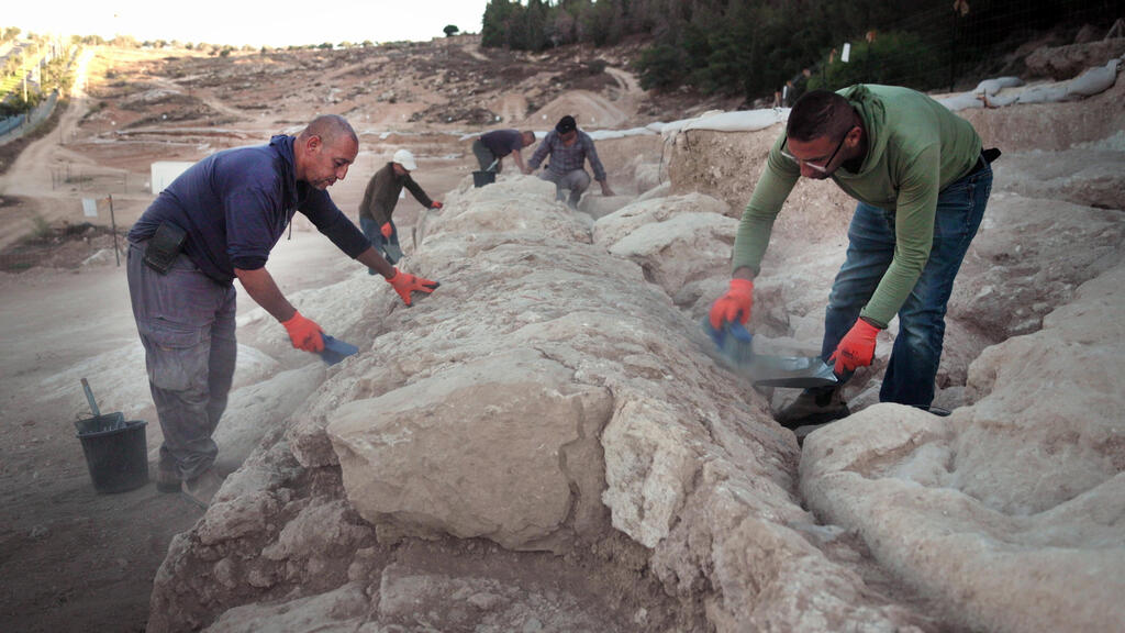
Israeli archaeologists have exposed a 300-meter (about 1,000-foot) stretch of Jerusalem's Lower Aqueduct, the channel that carried spring water from south of Bethlehem to the Temple Mount, the Israel Antiquities Authority (IAA) announced on Sunday, October 11, 2026. The section turned up south of Kibbutz Ramat Rachel during a rescue dig ahead of a housing development. It is an excavation announcement, presented at a Jerusalem archaeology conference, not a peer-reviewed study.
The dig directors, Benyamin Storchan and Gil Freid, say the structure was probably built in the days of the Hasmonean kings, the dynasty that ruled Judea from roughly 140 to 37 B.C., according to Aleteia. The word “probably” carries the story. It is an attribution, not a date measured for this stretch.
A stone channel that drops one meter per kilometer
The find came on land where the Israel Land Authority plans a new neighborhood. The Times of Israel reports that the project is many years from completion and could include up to 1,800 housing units. The excavation, led by Storchan, Freid and Rotem Cohen, took place before construction.
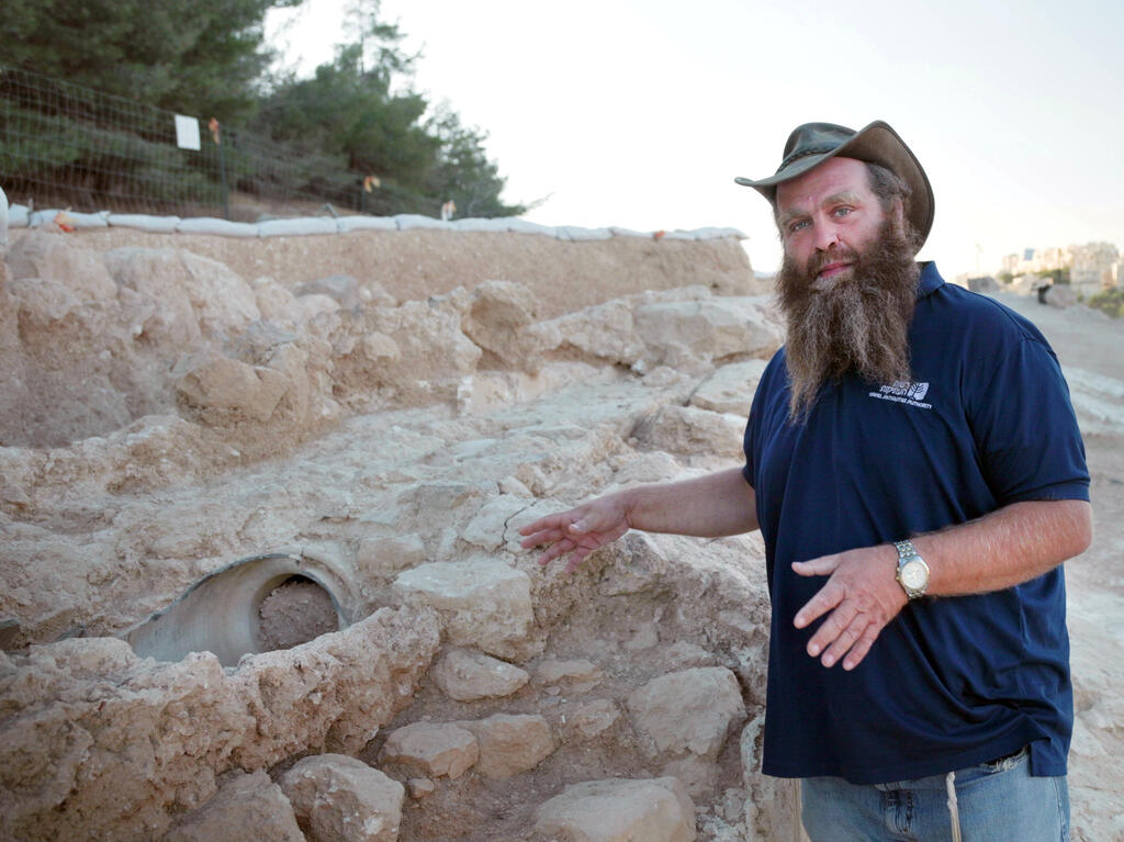
Don't picture the soaring arches of Caesarea or Italy. Storchan told the paper the structure is a wall of two rows of stones with a U-shaped, plastered channel inside, probably capped with stone slabs. Water moved by gravity alone. The elevation difference from start to finish is only about 30 meters over 21 kilometers (13 miles), an average drop of one meter per kilometer, according to the Times of Israel and Ynetnews. Where a hill blocked the way, builders cut tunnels to keep the slope, and cleanout points gave workers access to clear blockages.
The stretch records several rounds of repair. About 500 years ago, in the Ottoman period, ceramic pipes were set inside the original channel. In an academic paper, Amit and Gibson put that work in 1541, under Suleiman the Magnificent. In the same phase the outer wall was plastered and small stones were pressed into the wet plaster, leaving a rough surface that the IAA says runs along the aqueduct's route, as the Jerusalem Post reports. Amit Re'em, the IAA's Jerusalem district archaeologist, called the aqueduct an “engineering marvel.” Storchan noted that the first surveyors worked with simple mathematics and got it right.
Nobody was surprised. Haaretz reports the section turned up exactly where archaeologists expected it, about five kilometers south of the Temple Mount. What changes is the detail. Only about two of the 21 kilometers have been excavated so far. Freid has used high-precision satellite mapping to estimate the course where modern buildings erased the channel, at least north of the Gilo neighborhood, the Times of Israel says. The paper adds that excavations in the West Bank fall under a different authority.
The Hasmonean date is the favored theory, but nobody has measured it at this spot
Dating an aqueduct is harder than it sounds. Pottery and coins found nearby can stay in circulation for decades, so, as Haaretz explains, archaeologists do a kind of reverse engineering, peeling back plaster layers one by one. Another method is to dig the fill packed against the channel wall: the latest object inside gives the earliest possible date for the construction.
That approach was used at Armon Hanatziv, also in Jerusalem, where Ya'aqov Billig found Second Temple pottery and coins in the fill, the latest attributed to Herod. The 2014 paper by Amit and Gibson, published in the proceedings of the Cura Aquarum in Israel conference, sums up the impasse: the aqueduct was in use in the Second Temple period, but absolute proof that it already existed under the Hasmoneans has not turned up. Billig nonetheless argues for a Hasmonean founding.
The positions have names and arguments. Amihai Mazar, who surveyed the whole system in 1969, has favored a Hasmonean date since 1971, though he acknowledged he had no precise data on the construction. Joseph Patrich proposed, on historical grounds, the reigns of John Hyrcanus or Alexander Jannaeus. A 2007 study by A. Solomon, based on the Qumran scrolls, pointed to about 152 B.C., in the time of Jonathan. Amit and Gibson think that is too early and prefer a date after Antiochus VII Sidetes besieged Jerusalem in 132 B.C. In the 19th and early 20th centuries, Conrad Schick and G. A. Smith credited Herod the Great.
The Times of Israel gives a construction date of around 100 B.C., a specific figure the IAA statement does not assert. Haaretz says the academic debate over dating continues. I found no absolute date, such as radiocarbon on the plaster, published for the Ramat Rachel stretch. The technique has been used on another aqueduct in the system: a 2021 study by Uzi Leibner and Azriel Yechezkael in the journal Geoarchaeology used radiocarbon on plaster to suggest the Biar aqueduct was built around the middle of the first century A.D.
Why the Temple needed so much water, and what Scripture says
The Bible never mentions this aqueduct. What it records is the demand for water in worship. God commands a bronze basin so Aaron and his sons can wash their hands and feet before serving (Exodus 30:17-21). On the Day of Atonement the high priest bathes his body in water before putting on the holy garments (Leviticus 16:4, 24).
Jerusalem was always short of water. According to 2 Kings 20:20, Hezekiah made the pool and the conduit that brought water into the city. Storchan says rainfall and the Gihon Spring were not enough in the Second Temple period, especially when the population swelled for the pilgrimage festivals. Luke 2:41-42 notes that Jesus' family went up to Jerusalem every year for Passover.
Amit and Gibson estimate a population of at least 50,000 and point to the need for water for ritual cleansing and for washing the sacrificial areas beside the altar. A single aqueduct delivered about 230 liters per minute. Later rabbinic sources they cite say the Etam spring stood 23 cubits above the Temple court (Yoma 31a) and that the high priest immersed in its water on the Day of Atonement (Zebahim 54b). On the Temple Mount the channel ended in a large cistern known in Arabic as Bahr al-Kabir.
The name Solomon's Pools comes from a tradition linking the reservoirs to Ecclesiastes 2:6, where the Preacher says he made pools to water a grove. Storchan calls the name a misnomer, Haaretz reports. Amit and Gibson write that only the two upper pools are older, that the lowest dates to the Mamluk era, in 1483, and that the Lower Aqueduct was first fed by the Etam spring near Artas and only later by the base of the lowest pool.
For Christian readers the question is whether Jesus drank this water. Douglas Estes, an associate professor of religion at New College of Florida, told Fox News, as Aleteia reports, that he is “confident” Jesus, the disciples and early Christians used water from the system. Aleteia itself cautions that no direct archaeological evidence ties specific people to the channel. What exists is an overlap in time: Amit and Gibson say the aqueduct was in use in the Second Temple period, and Herod's building projects demanded large amounts of water. John 7:2, 37-38 places Jesus in the Temple at the Feast of Tabernacles, inviting the thirsty to drink, and commentators link the scene to that feast's water ceremony. That is inference, not a find.
Where some headlines stretch the facts
The word “discovered” implies news that isn't new. The route was known. Edward Robinson followed the line in 1838, Mazar mapped it in 1969, and Yonatan Nadelman excavated 150 meters of it in 1997 and 1998 below the Diplomat Hotel, identifying six construction stages, the earliest Early Roman. The Times of Israel lists segments already exposed in Armon Hanatziv, Giv'at HaMatos, Ramat Rachel and East Jerusalem.
Some outlets, such as the Algemeiner, call the section “remarkably preserved” and say the aqueduct served for nearly two millennia. The IAA speaks of intermittent use. Haaretz says no one can claim uninterrupted use from the Hasmonean, Herodian or Roman periods to the British Mandate. Amit and Gibson judge that the Lower Aqueduct was abandoned after A.D. 70 until it was rebuilt in the Byzantine period, and they cite Lamentations Rabbah 4:4, which says the Sicarii destroyed the aqueduct that came from Etam.
Another mix-up involves Pontius Pilate. Josephus says the governor used sacred Temple money to build an aqueduct (Jewish War 2.175-177; Antiquities 18.60). Mazar linked that project to the Arrub branch, which feeds Solomon's Pools by a different route, not the Lower Aqueduct. Amit and Gibson note even that is not certain.
Finally, “from the time of Jesus” fairly describes when the aqueduct was in use, but it does not settle when it was first built, and that question remains open.
What happens to the stretch, and what remains unknown
The IAA and the Israel Land Authority plan to preserve the section and fold it into the main entrance of the new neighborhood, where it can be seen from all sides. Re'em describes a long-term vision of a continuous park, developed with the Jerusalem Municipality, that would let visitors walk from southern Jerusalem to the Old City. According to the Times of Israel, the neighborhood would link Ramat Rachel with Giv'at HaMatos and Har Homa and would block a contiguous expansion between East Jerusalem and Bethlehem, to the dismay of international organizations.
On the scientific side, the open questions are concrete: the absolute date of the first channel, whether the plaster layers at this site can supply one, and how much of the 21-kilometer route survives under the modern city. So far the public information comes from a press release and interviews. A technical report on the Ramat Rachel stretch could not be located.
Historic Matson Collection photograph from the Library of Congress: the Wadi el-Biyar aqueduct flowing into the upper pool of Solomon's Pools, the reservoirs that fed the channels to Jerusalem. Photo: Matson Collection, public domain, Wikimedia Commons